
CloseParalelPolylines
Purpose: Automatically connect two open or parallel-like entities and merge them into one continuous polyline Supported objects: LWPOLYLINE, LINE, ARC, SPLINE Usage style: Cleanup or closing gaps between two aligned open objects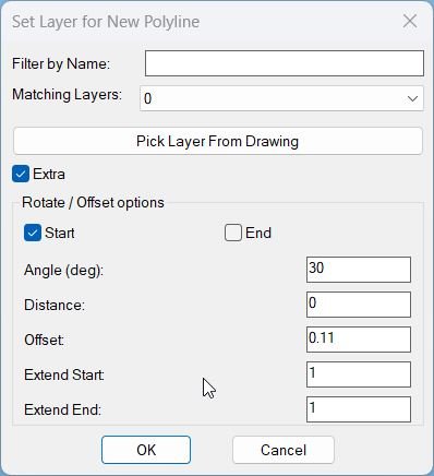
CopySelection_vs.01
Sort / Purpose: Create a new polyline segment copied between two picked points on an existing LWPOLYLINE, place it on a chosen layer, and optionally extend, rotate, move, and generate multiple offset copies via an interactive dialog with Apply and Undo. • Scope: Works only on a selected LWPOLYLINE, extracting the portion between two points along the polyline and building a new, separate polyline from that segment. • Goal: Speed up creation of repeated pipe or band segments with controlled layer assignment, geometric extension at ends, rotation, perpendicular distance, and multiple parallel offsets using presets.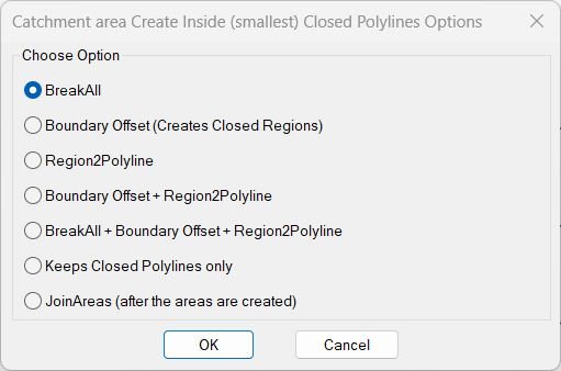
InteriorPolylinesArea
Purpose: Provide a unified dialog interface for running multiple area-processing operations inside closed polylines Use cases: Creating inside boundaries, breaking curves, converting regions to polylines, filtering out open polylines, or joining areas Memory: Stores last chosen option in *BR2P-last-option* and auto-selects it next run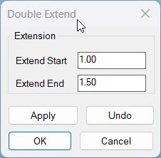
Lengthen
Sort / Purpose: Interactively extend lines, arcs and polylines at both start and end by user defined distances, using a dialog with separate values for each side and safe Apply or Undo control. • Scope: Works on LINE, ARC, LWPOLYLINE and classic POLYLINE entities, handling straight and bulged segments at both ends. • Goal: Provide a flexible Double Extend tool where you can tweak start and end extension, preview the result with Apply, step back with Undo, and only confirm when you are satisfied.MiddleLinePolylines_2
Purpose: Create a simple two vertex centerline between two selected open curves using only their endpoints Supported objects: LINE, LWPOLYLINE, POLYLINE, ARC, SPLINE, ELLIPSE when they are open curves Usage style: Quick central axis between two roughly parallel edges selected as first and last items in a selection set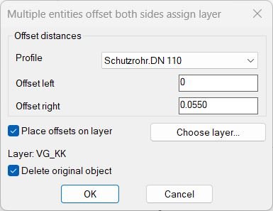
MultiOffsetBothSidesWithLayer
This AutoLISP routine automates the process of offsetting multiple lines on both sides with customizable distances, profiles, and layer management. It is designed to simplify symmetrical drafting operations by providing an interactive dialog for user control and configuration.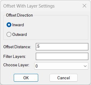
OffsetAndLayer
Purpose: Offset curves inward or outward and assign the results to a selected layer Supported geometry: *POLYLINE, ARC, CIRCLE, ELLIPSE, SPLINE (planar only) Session memory: Remembers last offset distance, last chosen layer, and last direction for faster repetitive usage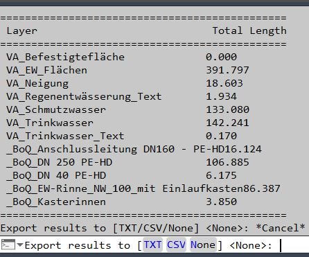
PLLengthByLayer
📏 AutoCAD LISP utility for calculating total lightweight polyline length by layer and exporting a clean TXT or CSV length report.
Region2Polyline
Purpose: Convert REGION objects into closed LWPOLYLINEs while preserving curve continuity and arc bulges Typical use: Cleanup of Boolean-created geometry or boundary extractions that output REGION entities Input object: REGION only — all selected REGIONs are processed Output format: Clean, closed LWPOLYLINE with correct bulges and segment orderingSlope_00
Purpose: Label slopes between two picked points using multiple numeric and ratio formats Scope: Works entirely in 2D, producing TEXT entities placed and rotated along the measured segment Workflow: Configure options in a dialog (DCL), then pick two points repeatedly to place slope labels Output style: Percent, H:V integers, V:H integers, H:V decimals (x.xx:1), or V:H decimals (1:x.xx) Defaults: Below=No, Height=1, H=1, V=1, Precision=2, Format=%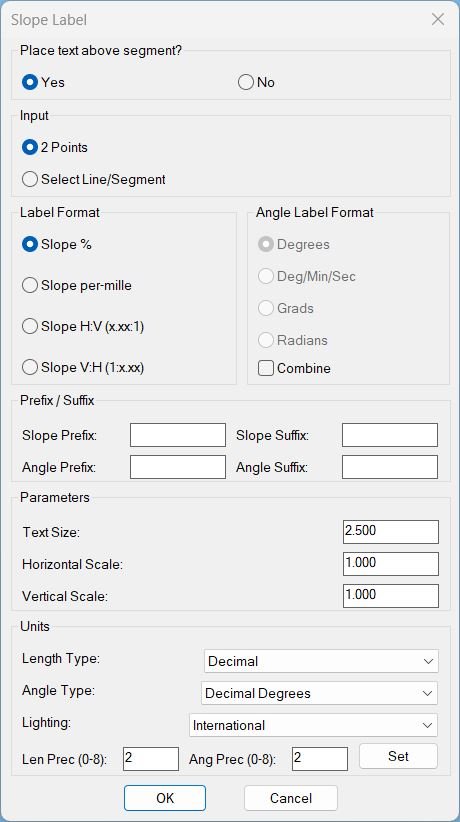
Slope_01
Sort / Purpose: Interactive slope-label placement tool for linework in Civil 3D / AutoCAD. • Type of tool: Dialog-driven annotation command that creates MTEXT labels. • Scope: Works on picked point pairs or on every segment of selected LINE / LWPOLYLINE / POLYLINE entities. • Goal: Quickly place readable slope (and optional angle) labels with user-controlled format, prefixes/suffixes and scaling.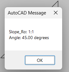
Slope_Ro
Purpose: Compute and report a simplified slope ratio and angle between two user-picked points Run style: Interactive two-point measurement with no drawing modifications Standard: Uses a fixed 12-unit horizontal run for imperial slope representation Output: Displays slope ratio and angle through an alert dialog only