
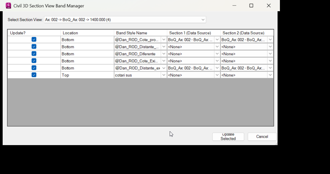
UpdateSectionBandSets
🚀 UpdateSectionBandSets is an AutoCAD Civil 3D .NET Framework plugin for editing Section View band sets, band styles, and section data sources from a focused grid-based dialog. It helps Civil 3D users update top and bottom section view bands faster, reduce repetitive manual edits, and improve section view annotation consistency in production drawings.
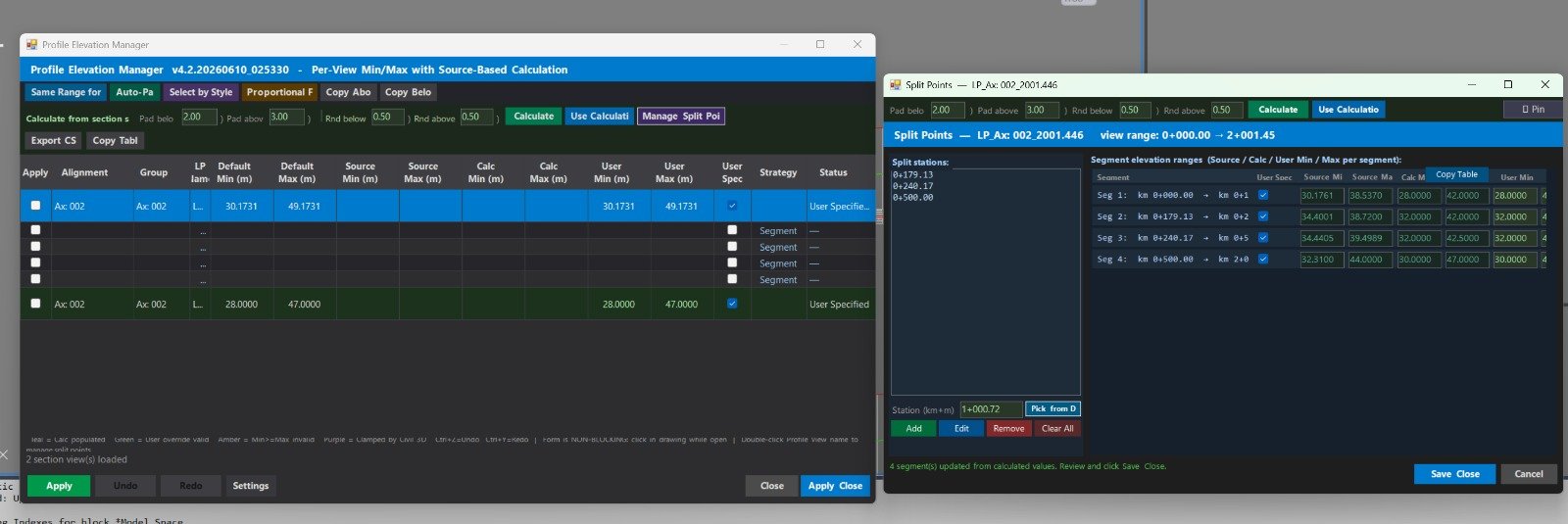
ProfileElevations
🚀 ProfileElevations is an AutoCAD Civil 3D .NET Framework plugin for managing ProfileView elevation ranges, profile view styles, band set styles, split profile view datums, and profile source elevation calculations.
📐 It helps Civil 3D users review multiple profile views in a grid, calculate source minimum and maximum elevations from profiles and network parts, apply consistent user-defined elevation ranges, and reduce repetitive manual editing in Profile View Properties.
🟢 The main benefit is faster Civil 3D profile view management, better drawing quality control, consistent vertical ranges, cleaner plan production, and safer batch editing with undo, redo, CSV export, import, logging, and settings.AssemblyLabel
🚀 Assembly MText Label is an AutoCAD Civil 3D labeling utility that creates a dynamic MText field label linked directly to a selected Civil 3D Assembly object.
📌 The main benefit is faster Assembly annotation, fewer manual text edits, and automatic label updates when the Assembly name changes.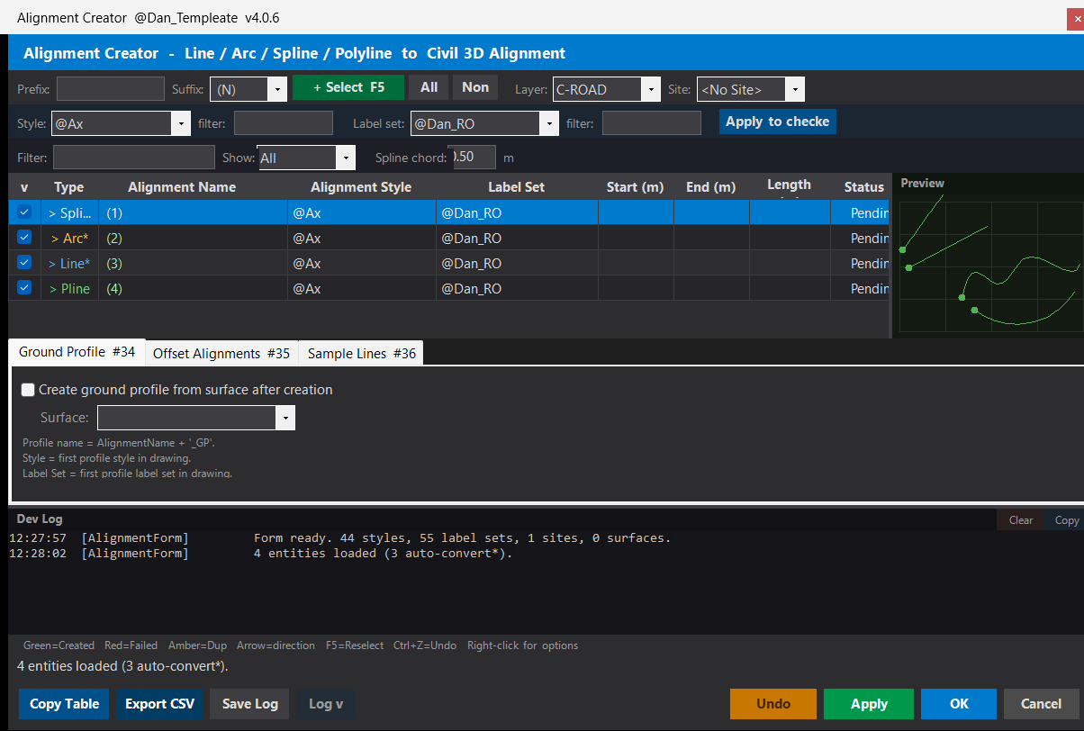
Polylines_Alignments
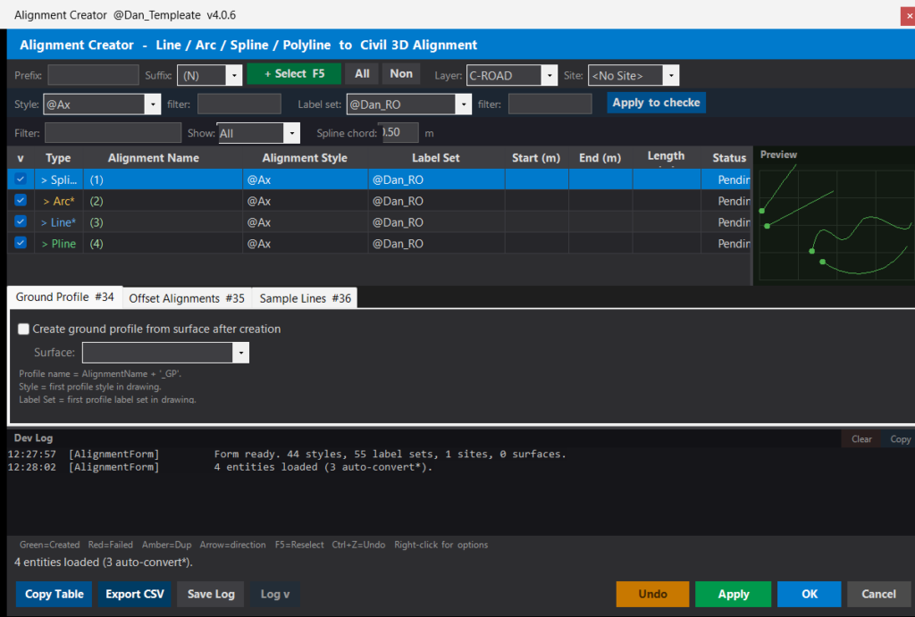
🚀 DANALIGN is an AutoCAD Civil 3D alignment creator workflow that uses an AutoLISP loader and a C# .NET plugin to batch-convert drawing geometry into Civil 3D alignments. The tool helps CAD and Civil 3D users select Lines, Arcs, Splines, Polylines, and compatible geometry, review the objects in a grid, apply alignment styles and label sets, and create production-ready Civil 3D alignments with fewer manual steps.
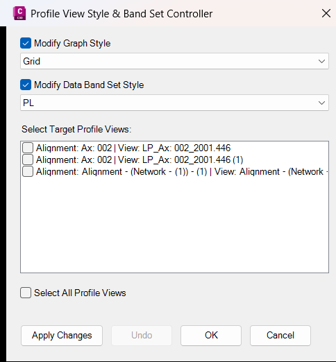
ManageProfileViewStyles
📊 Civil3DProfileViewUtils is an Autodesk Civil 3D C# .NET plugin that manages Profile View and Section View styles from a custom dark-themed Windows Forms dialog. It helps Civil 3D users apply graph styles and band set styles to multiple ProfileViews or SectionViews at once, reducing repetitive style editing and improving drawing standardization.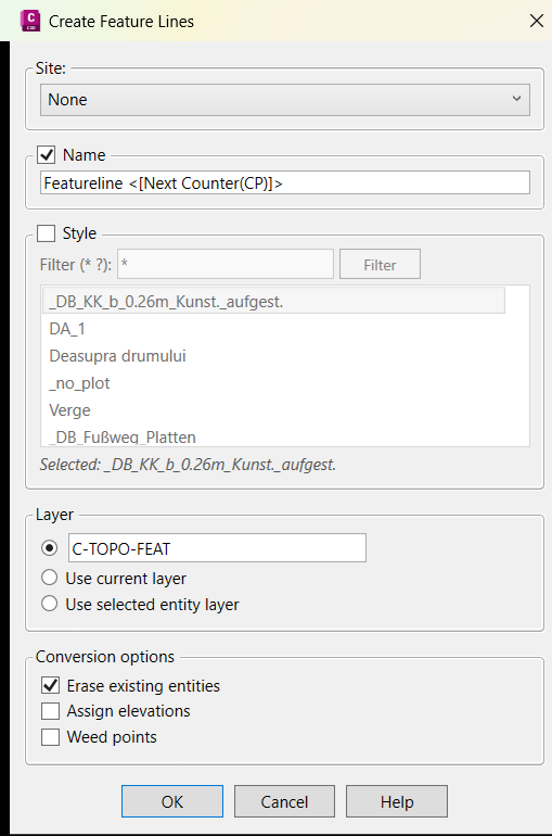
FeatureLinesStyleExtra
🚀 CivilFeatureLines is an Autodesk Civil 3D C# .NET WPF plugin that creates Civil 3D feature lines from selected drawing objects. It improves the standard create-feature-lines-from-objects workflow by adding wildcard feature line style search, custom layer control, optional elevation assignment, source object cleanup, weed-point support, version banners, and detailed command logging for Civil 3D production workflows.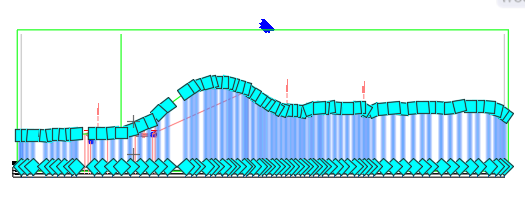
C3DExploder
🚀 C3DExploder is an AutoCAD Civil 3D C# .NET plugin project with an AutoLISP loader that converts selected Civil 3D objects into native AutoCAD geometry. The tool helps Civil 3D users create AutoCAD polylines, 3D polylines, lines, rectangles, and MText labels from supported Civil 3D entities, while logging the conversion process for QA review, drafting cleanup, and AutoCAD deliverable preparation.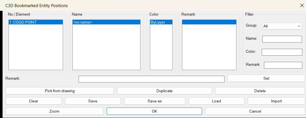
BookmarksC3DEntities
🔖 BookmarksC3DEntities.lsp is an AutoCAD Civil 3D AutoLISP bookmark manager that lets users save selected Civil 3D entities into a searchable navigation list. The tool stores object type, object name, color, bounding-box location, handle, and user remarks so designers can quickly zoom back to important alignments, profiles, profile views, corridors, pipes, structures, COGO points, surfaces, sections, assemblies, and other Civil 3D objects.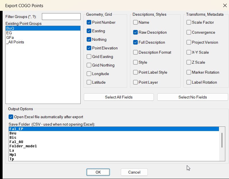
CogoPointsExport
📤 CogoPointsExport.lsp is a Civil 3D AutoLISP export utility that exports COGO point data from selected point groups to Excel or CSV. The tool helps AutoCAD Civil 3D users filter point groups, choose export columns, generate Excel workbooks, save timestamped CSV files, and speed up survey point reporting, QA checking, and project documentation.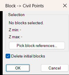
Block2CogoPoints
📌 Block2CogoPoints.LSP is a Civil 3D AutoLISP utility that converts selected AutoCAD block references into Civil 3D COGO points. The tool reads block insertion points, transfers attribute information into point descriptions, previews Z min and Z max values, and optionally deletes the original blocks for a cleaner drawing workflow.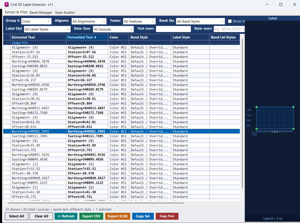
GetLabelText
Civil 3D Label Extractor — audit, filter, and export all band label text from Profile Views and Section Views in a single modeless panel, without blocking AutoCAD workflows.CogoPoints2Structures_vs.01
Purpose Create a copied Civil 3D structure at each selected COGO point, positioned and elevated from the point data. Scope Works directly with AeccDbStructure and AeccDbCogoPoint objects using COM, without AeccXUiPipe or AeccPipeApplication dependencies.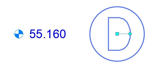
CogoPoints2Structures_vs.00
Sort / Purpose: Create a Civil 3D Structure (AeccDbStructure) at every selected COGO point, by copying a user-chosen template structure and placing the copies at each point’s location with rim set to point elevation. • Scope: Batch “stamp” manholes/inlets/etc. on COGO points. • Dependency: Uses only AeccDb COM objects (no AeccXUiPipe / AeccPipeApplication), so it avoids Civil 3D COM version issues.
CopyC3DEntitiesToClipboard
📋 CopyC3DEntitiesToClipboard.lsp is an AutoCAD Civil 3D AutoLISP clipboard utility that duplicates selected entities, explodes the temporary copies, extracts generated TEXT and MTEXT values, copies the cleaned text to the Windows clipboard, and erases the temporary exploded geometry. It helps Civil 3D users copy visible label information quickly without intentionally exploding the original selected objects.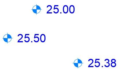
CogoPointElevation2Clipboard
📐 CogoPointElevation2Clipboard.lsp is a Civil 3D AutoLISP clipboard utility that copies elevations from selected COGO points directly to plain text. The tool helps AutoCAD Civil 3D users quickly extract point elevation values, paste them into Excel or reports, and reduce manual point property checking during survey review and CAD quality control.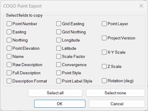
CogoPoinsInfoToClipboard
📋 CogoPoinsInfoToClipboard.lsp is a Civil 3D AutoLISP clipboard export utility that copies selected COGO point properties directly to plain text. The tool helps AutoCAD Civil 3D users extract point numbers, coordinates, elevations, descriptions, styles, layers, scale, rotation, latitude, longitude, and project version information without manually checking each point.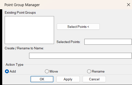
AddPoint2Group
🧩 AddPoint2Group.LSP is a Civil 3D AutoLISP point group management utility that helps users add selected COGO points to a point group, move points between point groups, create new target groups, and rename existing point groups from a simple DCL dialog. The tool improves Civil 3D productivity by reducing manual point group editing and making point organization faster, cleaner, and more controlled.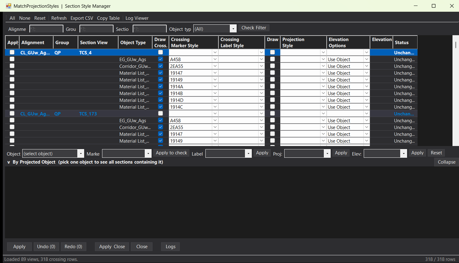
matchprojectionstyles
🚀 MatchProjectionStyles is an AutoCAD Civil 3D .NET Framework plugin for managing Section View styles, projected object styles, crossing marker styles, crossing label styles, and elevation options from one modeless manager.
📐 It scans Civil 3D alignments, sample line groups, sample lines, section views, and section crossing data, then lets production users review and apply style changes in a grid-based workflow.
✅ The main benefit is faster Civil 3D section view cleanup, consistent projection and crossing styling, fewer repetitive dialog steps, and better quality control for AutoCAD Civil 3D drawing production.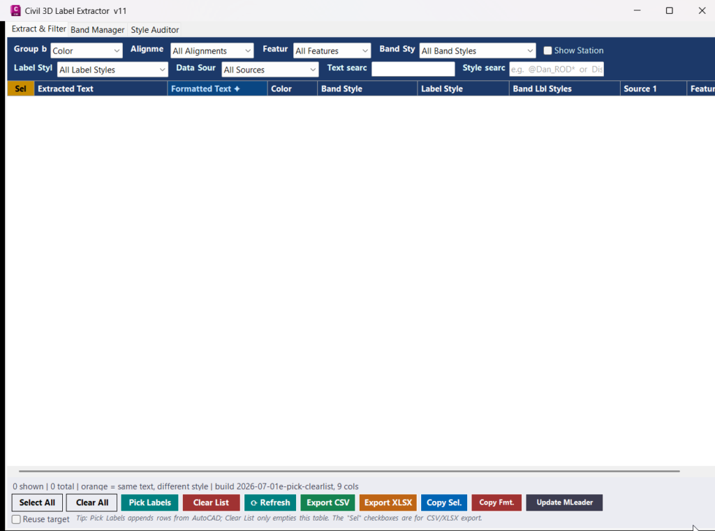
GetLabelText_vs.01
Short description The GetLabelText project is an AutoCAD Civil 3D .NET plugin designed to extract, review, filter, export, and reuse label text from Civil 3D…
Polylines_Alignments_vs.01
AutoCAD Civil 3D .NET Plugin Shadow-Copy Loader — loads a managed DLL into AutoCAD without locking the source file, enabling live rebuild-and-reload without restarting AutoCAD.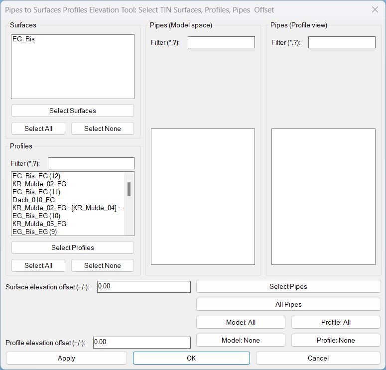
Pipes2SurfacesProfilesElevationTool_vs.01
Sort / Purpose: Civil 3D utility to set pipe invert elevations from selected TIN Surfaces and/or Profiles, using separate elevation offsets for each source and a scrollable, filterable UI for many pipes. • Scope: Works with AeccDbPipe (model), pipe profile-views, TIN Surfaces and Profiles, using wildcard filters and “Apply” inside the dialog so you can tweak/preview without closing it. • Priority: For each pipe, it tries Profiles first, then falls back to Surfaces if no valid profile elevation is found at pipe ends.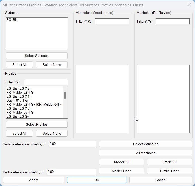
MH2SurfacesProfilesElevationTool_vs.01
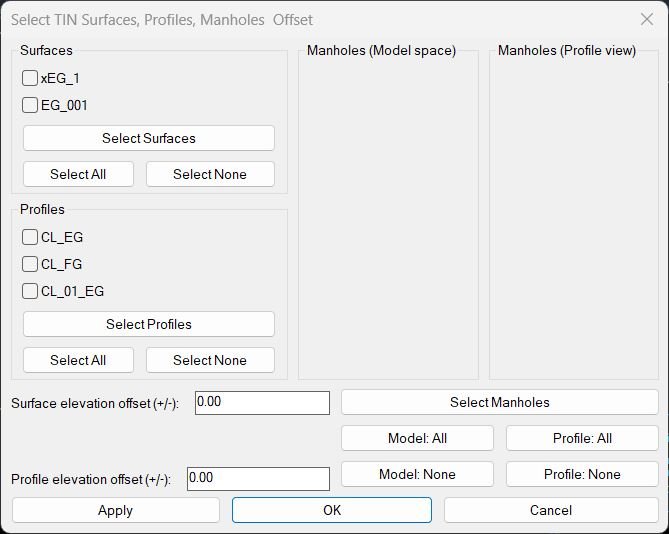
Sort / Purpose: Civil 3D utility to set structure (manhole) elevations based on TIN Surfaces and/or Profiles, using a scrollable dialog with filters. • Scope: Works withAeccDbStructureand profile-view network parts, using profiles or surfaces as elevation sources, with separate offsets. • Priority: For each manhole, it tries Profiles first; if no valid profile elevation, it falls back to Surfaces.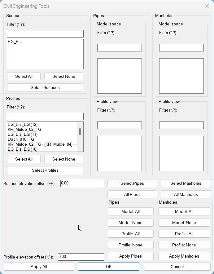
MHPipes2SurfacesProfilesElevationTool_vs.01
Sort / Purpose: A pipe-only shortcut command that still launches the same full UI. User may ignore manhole lists if not needed.- Type: Shortcut alias to the master interface
- Scope: Provides access to all pipe-related elevations
- Goal: Simpler entry for users working only with pipes
MH2SurfacesProfilesElevationTool_vs.00
Short description
This LISP adjusts Civil 3D manhole structures so their rim elevations follow selected TIN surfaces or profiles, with elevation offsets, batch selection and a dialog that supports live Apply preview and final confirmation.

Pipes2SurfacesProfilesElevationTool_vs.00
Short description This LISP lets the user align Civil 3D pipes to chosen TIN surfaces and or profiles using elevation offsets, with a dialog that supports multi selection, live Apply preview and final OK or Cancel confirmation.
Categories: AutoCAD_Lips
Categories: AutoCAD_Lips